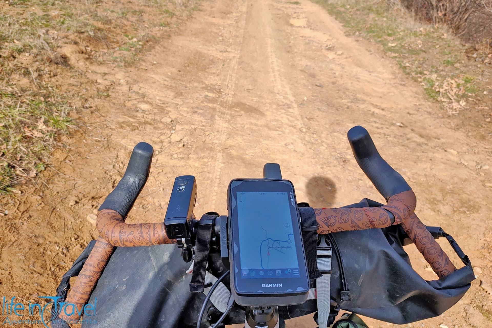
One of the GPS outdoor Apps I mostly use is Oruxmaps. It's a free, complete and updated App, really good for MTB excursions, outdoor trekking, for your first trips on secondary roads and for bicycle navigation in general. The only downside is its learning curve: it's not an intuitive App, it cannot be used and right away understood, but with some effort, you'll be able to appreciate it. It requires dedication to be fully understood, so I'll try to guide you, recapping som of its main features. At the end of this article, you'll find a short movie about this mountain bike App.
The first thing you have to know is that this App is only available for Android users, while for iOS users I suggest looking at GPS Kit, but honestly, I don't use an iPhone so I don't know how it works and I cannot give my personal advice.
Back to us: you can download Oruxmaps on Google Play and install the App on your smartphone or tablet. Now let's see how to proceed and start using this GPS App with satisfaction. This Oruxmaps guide is not a complete overview of all the numerous features available in this App, but only a short presentation of some useful gems of this great free App.
Oruxmaps Main Menu
Once you launch Oruxmaps, the main screen will be like the picture below: an online map will be loaded, usually the "World" map by OpenStreetMap. Up you'll find the main menu, on the sides you can open two sidebars with many functions (zoom, GPS on/off, start recording...). Under the main menu, on the left, there is the status bar and down you'll find the scale and the dashboard (following the definition from the user manual that you can download from the website oruxmaps.com).
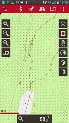
Let's take a look at the main menu. From right to left you'll find the following features:
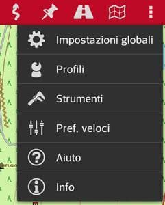
- Settings

- In this part of the menu, you'll be able to modify the Global Settings changing the user interface, the profiles, the maps and tracks default settings (for example the folders where they are stored), the sensors, the units and many more. Among the Tools you can measure distances or areas on the map, you can view the state of the GPS signal and its accuracy (by downloading the App GPS status), you can access fast default settings, user manuals or information about the App. I personally seldom use this menu.
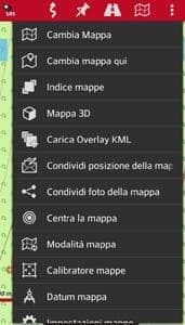
- Maps

- The second menu from the right is dedicated to maps. In this case, you'll find many options: the first and most useful allows to select the background map among the online and offline maps on the device (we'll see how to download the maps). Furthermore, you can upload 3D Maps if you have a DEM file of the area of interest (altimetric data), upload Overlay KML (layers overlaying the background map), share your position on the map, center the map on a specific point (selected point, track or route starting point, map center, last GPS position). There are more options, not treated in this short guide.
- Routes

- Another useful menu is Routes. In this case, we can look for a route of interest, marking points on the map, we can create our own tracks, load or manage our GPX or KML files already in our database. I personally use this menu to manage my tracks and to load other users' to follow during my MTB excursions.

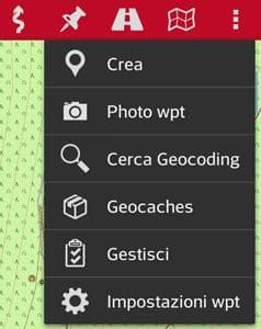
- Waypoints

- Another menu used mostly during tracking time is Waypoints. It will allow you to mark some points of interest during your activities, also geotagging a photo. I personally don't use geocaches, that you can find in this menu.
- Tracks

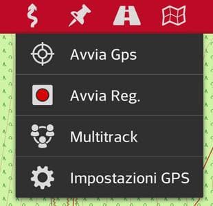
- The last menu is the main one of this mountain bike GPS App. Here you manage the start of the GPS signal, the recording of a new track, the multitrack and the GPS settings (GPS fix accuracy, coupling with an external GPS, NMEA correction of the geoid...).
Downloading the maps
Once installed the App, the first operation to do is to download the maps on our device (better on an SD card) in order to use them on the field even without a stable connection. You can also use online cartography, but I personally discourage that, because you might face two problems: usually, going to the mountains, the connection isn't always good and you risk not being covered by any connection; secondly using the internet on your device might drain its battery during the activity. Let's see how to download the outdoor maps for Oruxmaps: you can proceed directly from the device or download them on your PC and then copy the files on the external Micro-SD card of the device. The maps suggested also by Oruxmaps devs can be easily found on Openandromaps.org (where you also find some Eurovelo routes for bicycle touring) or on 4Umaps, OSM data based. A list of the available maps has been published on the official site of the App this is the page for Europe.
Here you find two ways of installation:
- Install offline maps directly from the device
- This operation can be realized with Openandromaps cartography. In order to install the maps open the website on whatever browser, then look for the download page (for example this is the page for Europe). Click on the "+" near the country/area of interest. A button Install on Oruxmaps will appear. The map will be downloaded and installed: keep in mind that maps are heavy (Italy is currently 650 MB), so use a capable MicroSD card (4/8 GB at least) and set the download from Oruxmaps on it (from version 6.0 this feature is automatic, but check anyway in Global Settings > Maps that the Folder where the maps are stored is external SD).
- Install offline maps from a PC
- To install maps on Oruxmaps from a PC you'll have to connect your device to it. Download the maps of your interest, for example from 4Umaps. In this case, you only need to download the .zip file, unzip it with specific software (WinRAR or Winzip on Windows) and load the folder on the external SD card of your device dedicated to Oruxmaps maps. If you want to install also maps from openandromaps connected to a PC, you find an exhaustive guide in English on this page.
An alternative in order to save maps offline is to "create" a map directly from Oruxmaps online maps: for this operation take a look at the Oruxmaps user's manual.
Following a GPS track
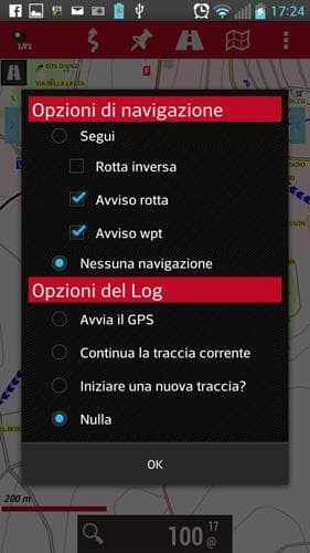
The first operation once loaded the map on our device is following a track downloaded from the internet. Firstly load the track on the device: like the maps, you can either load it directly from the device or via PC, only the folder where to copy the GPX track will be different (.../oruxmaps/tracklogs). To find MTB or trekking tracks you can take a look at the download area of LifeInTravel. Once you have your track in the correct folder, you can load it onto the map: from the Routes menu, select the first voice Load KML/GPX file. Select the desired track, then you'll have different options like in the following picture (left). We can generally choose the navigation option Follow and the Log options Start GPS. Now we can start the GPS reception in the device settings and ride (or walk) following the track!
Recording a GPS track
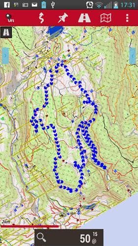
Recording a GPS track with the App Oruxmaps is pretty easy: once started, activate the GPS reception on your device settings through Tracks > Start GPS and before leaving, always from the Tracks menu, select Start Rec. Now your track will be recorded and down on the screen, you'll be able to see the Dashboard with some information about your MTB track (see picture below). If you want to mark a Waypoint or a Photo Waypoint, you can do it by pressing the right button, while at the end of your trip you'll have to remember to stop the track recording (always from the Track menu) and deactivate the GPS.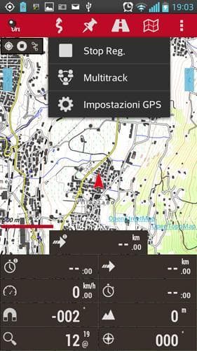

These are the basic features of Oruxmaps, GPS App for Mountain Bike and outdoor activities. Remember that it will be hard (if not impossible) to replace the work of a dedicated GPS device with a smartphone, mostly for the GPS signal accuracy. Another really good App is Locus Maps. If you are curious, take a look at the Guide to Locus Map, outdoor GPS App. Furthermore, make sure to have enough battery with an External Battery Pack, because using the GPS on your smartphone can drain the battery out really fast.


